The construction of Highway One in the late 1940s has had a profound impact on our Aptos community. Before there was a Highway One there was the Santa Cruz-Watsonville Road which passed right through Aptos Village. Today the old highway is called Soquel Avenue where it connects to Santa Cruz, Soquel Drive in the mid county, and Freedom Boulevard as it turns toward Watsonville. Originally the road followed Native American foot paths which then became Spanish horse and wagon tracks.
In 1919, there were over 6 million cars in America. By 1929 there were 26 million. Construction of Highway One began in 1919 as part of a vision to connect a road from Mexico to Canada. The highway was built as a series of separate projects. In 1933, the old highway, the Santa Cruz Watsonville Road was given the designation, State Legislative Route Number 56, (LRN 56).
In 1941, the state budgeted $461,360 to build a new 7.74 mile highway from Watsonville to Rob Roy Junction in Aptos, bypassing the Freedom Blvd. portion of the old highway. The first spade full of dirt was turned on February 13th. The plan was to fund the highway from Aptos to Morrissey Avenue in the next funding cycle two years later but World War II intervened. The new highway veered onto Soquel Drive east of Aptos Village for the balance of the war.
In January of 1944 the State Highway Commission voted to include the Aptos to Santa Cruz project in the post war improvement program. Governor Earl Warren decided that California highways were outdated, and that new construction should be freeways.
$2,428,000 was budget for the freeway to Santa Cruz in the 1948-49 state budget. Forty families would be displaced by this portion of the road generating some local resistance.
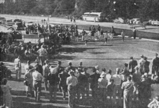
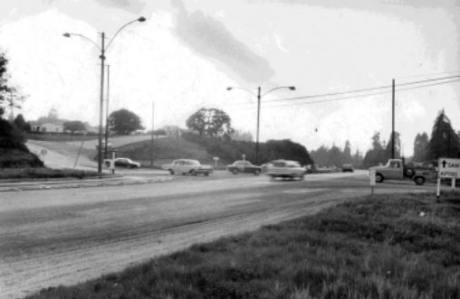
The blue and gold ribbon stretched across the new highway at Rio Del Mar Blvd. was cut on November 4th, 1949, by Governor Warren and the mayors of Santa Cruz, Watsonville and Capitola, opening 7.65 miles from Rob Roy Junction to Morrissey Blvd. Over a thousand people attended the ceremony. The high school bands of Santa Cruz and Watsonville played as
majorettes twirled their batons. The first weekend saw over 23,000 cars using the new highway. The extension from Morrissey to the Los Gatos Highway, (17) was completed in 1958.
The new highway completely by-passed the original Santa Cruz-Watsonville Road isolating every town including Aptos Village.
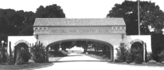
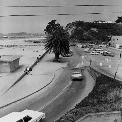
Rio Del Mar Boulevard once had a grand entrance gate to the country club properties. The famous Deer Park Tavern was to the west of the gate and the Peninsula Properties/Rio Del Mar sales office, a gas station and small snack shop were across the street. The new highway plowed right through this intersection. The only reason the tavern still exists is because the owners jacked it up and moved it up the hill to its present location. Today it is Bittersweet Bistro.
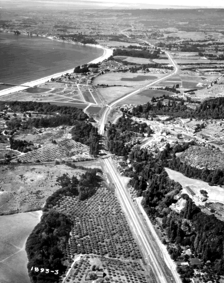
The new highway cut through several ridges between Rio Del Mar and Aptos Creek and the route was graded down toward the approaches of the new bridge over Aptos Creek. Vast quantities of dirt were moved and much of it was pushed onto the old highway and adjacent properties which raised some properties as much as six feet. Also, Aptos used to have a famous mineral spring across the street from Loma Linda Apartments, 9012 Soquel Drive, and down the bank toward Valencia Creek. The spring dried up when the new highway was built.
Between Freedom and Rio Del Mar Boulevards, Valencia Lagoon was a lake that captured the runoff from the areas bordering Freedom Boulevard. The new highway cut through this area and reduced the lagoon to a small, nearly invisible wetland now obscured by trees and brush. During the 1970s this area became the Protection District for the endangered Long Toed Salamander.
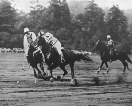
When Aptos began to develop in the late 1920’s, the developers shared amenities regardless of who actually owned them. Rio Del Mar, Seacliff Park and the Forrest Glen developments all
worked together to help sell homes and lots to prospective buyers. Each development claimed to have horseback riding, polo fields, turkey shoots, the world’s largest freshwater swimming pool, an airport, fishing, golf and tennis. When prospective land buyers for any of these developments arrived, they were lodged at the former Spreckels mansion or the golf lodge and they were
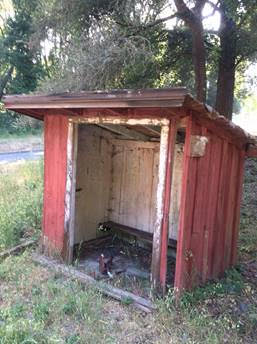
treated to a picnic barbeque at “Moosehead Redwood Park”. It was once located on the creek upstream of Spreckels Drive and could hold up to 500 people. It was formerly located where today’s southbound freeway passes a large turnout and stand of redwood trees.
Farther west, the new highway cut the Seacliff Park development into two halves. The Seacliff entrances were formerly off Soquel Drive at Borregas Drive, Mar Vista Drive and State Park Drive. The Best Western Seacliff Inn, Rancho Del Mar Center and The Farm Bakery are actually in Seacliff.
The new highway did not have an exit to Aptos Village. The Aptos exits are at Rio Del Mar Boulevard and State Park Drive. These two exits became prime locations for new shopping centers. Local neighbors tried their best to stop the Rancho Del Mar Center development in the early 1960s. Deer Park Center came in the late 1970s. With no industry and little retail to compete, Aptos Village severely declined. Even the Bay View Hotel closed for a time. Our community came to be defined by two shopping centers.
California State Highway One was officially renumbered in 1964. When the highway opened, Rio Del Mar Blvd. did not have an overcrossing. Residents had to cross the highway to get to Aptos Village or Santa Cruz and serious accidents were common. Construction of the overpass began in 1967 and was completed on November 16th. Today Highway One handles an average of 100,000 cars per day through our community, although not very well, but far better than Soquel Drive possibly could.
Aptos originally prospered because Fredrick Hihn brought the railroad across two creeks to reach today’s Village which he essentially owned. This allowed him and others to access the vast stands of redwood timber in the hills. That same railroad restricts both the old highway and the new highway with four major trestle crossings. Currently, there are plans to replace the Highway One trestles to allow for freeway widening and accommodation for the rail line and a trail. No
other town in the county has the potential to have passenger rail service available on the main street of town. The trail will allow bicyclists and walkers to access the historic Village and the new development. Aptos Village will once again reclaim its title as the heart of our community.